
The County Government of Nakuru is actively pursuing strategies to leverage data-driven urban planning and technology to address rapid urbanization challenges and drive sustainable development.
The devolved unit’s administration has indicated that its increased investments in smart city initiatives, such as internet-enabled infrastructure and data-driven urban planning, were also aimed at optimizing resource management, creating efficiencies, enhancing quality of life of residents and promoting economic growth.
County Director of Urban Development Mr Sammy Ngige, noted that the integration of Internet of Things (IoT) sensors, big data analytics, and artificial intelligence (AI) in urban planning enables real-time monitoring, predictive maintenance, and optimized resource allocation, leading to better urban planning and more resilient infrastructure.
He noted that Governor Susan Kihika’s Administration was working with various State agencies and international entities, to actively establish a Spatial Data Infrastructure (SDI) towards improving resource management for data-driven urban planning and development.
The initiative, which includes the setting-up of a Geographic Information System (GIS) lab is expected to streamline the administration of development projects and enhance resource allocation based on data analysis.
While observing that the County Government has initiated a comprehensive Urban Profiling Initiative aimed at enhancing the planning, management, and delivery of sustainable urban services in the region, Mr Ngige said data-driven planning reduces waste, and enhances sustainability in urban systems such as transportation, energy and water among others.
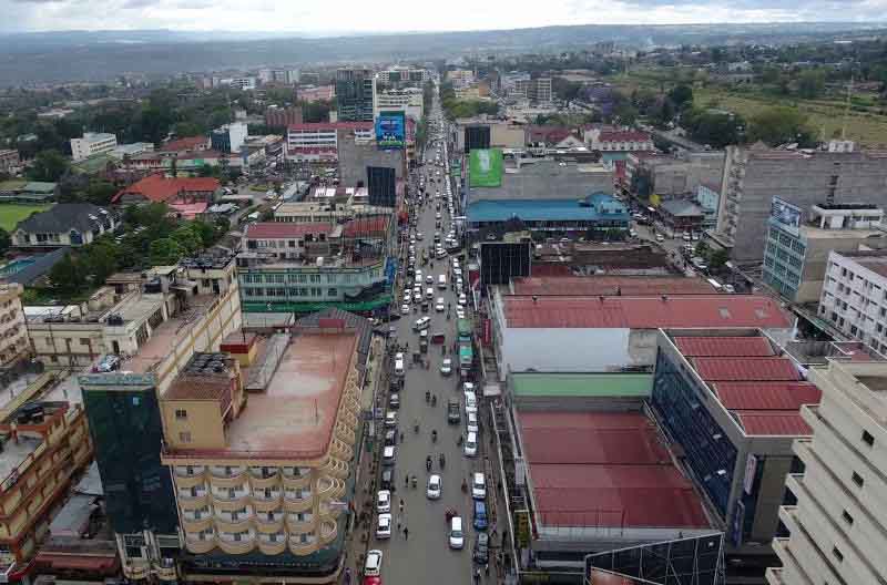
“This Urban Profiling Initiative exercise seeks to collect and analyze key data on urban infrastructure, housing, mobility, demographics, economic activities, social services, and environmental conditions across Nakuru’s rapidly growing urban areas. The profiling will cover all the 11 Sub-counties of Nakuru,” he disclosed.
Speaking during a meeting with the county’s urban planners, the Director described data driven planning as a road map to inclusive, resilient and sustainable urban areas through accurate and community-driven data.
“The urban profiling initiative is part of Governor Kihika’s urban Agenda on Urban data that will inform the review of the County Integrated Development Plan (CIDP) among others. The exercise will include Geographic Information System (GIS) Mapping, household surveys, citizen engagement and interviews,” he elaborated.
In June last year representatives from the World Bank met with officials from the County Lands and Physical Planning Department and the State Department of Housing and Urban Development for an engagement session to assess the Geospatial data needs and potential support areas within the Municipal Spatial Data Infrastructure (MSDI).
Mr Ngige assured that a regulatory framework is being developed to address data sharing and security concerns related to geospatial information.
Clause 105 (f) of the County Government Act 2012 requires county governments to establish GIS-based database systems for provision of data in the development of the County Integrated Development Plan (CIDP).
The technology is important for decision making during planning and allocation of resources for the Annual Development Plan (ADP).
By adoption of data driven planning, Mr Ngige pointed out that there is increased government-citizens engagement, leading to effective data-driven policy formulation and decision-making for safer communities through digital surveillance, efficient transport and communication system, use of environmentally friendly solutions, increased digital equity, efficient public utilities, improved infrastructure, highly effective workforce and new economic development opportunities.
The Director disclosed that the Spatial Data Infrastructure is being designed to play a crucial role in various sectors, including infrastructure planning, natural resource management and disaster response.
Highlighting the transformative power of the GIS component in the SDI, and its critical role in urban planning, tackling encroachments, and in promoting public feedback, Mr Ngige said he was hopeful that the GIS laboratory system will improve development planning and management.
The GIS lab is expected to provide a platform to store and manage digital footprint of development projects in sectors such as water, education, health, roads, rangelands, environment and natural resources.
He elaborated that the GIS laboratory system will further help local and foreign investors to conveniently access land information.
While noting that setting-up of the Spatial Data Infrastructure was in line with Governor Kihika’s Manifesto to digitize access to some essential services, to shorten the time and reduce the cost of access to services, the Director indicated that the system will help them collect, process and analyze data in digital form.
He pointed out that the initiative aims to address challenges related to data duplication, improve resource management, and facilitate effective governance.
“We aim to provide better access to spatial data, reducing wastage and duplication. By providing a standardized approach to data management, we make more informed decisions. The initiative promotes the production and sharing of spatial data for sustainable development,” he elaborated.
The Director noted that in Africa geospatial technology is necessary because the continent still faces numerous challenges such as unplanned settlements, degraded rangelands, inadequate or unplanned infrastructure, low quality of development projects, poor monitoring systems, mushrooming of new settlements and inequitable resource allocation due to lack of appropriate tools for decision making.
“We have resolved to use GIS technology cognizant of these challenges and the need to streamline monitoring of development projects and ensure equitable resource allocations based on evidence,” the Director explained.
GIS uses location-based data collected via satellites, paper maps, and directly from the field through mobile positioning devices to map out resources for analysis and decision-making.
By Anne Mwale


 promotes public awareness")