
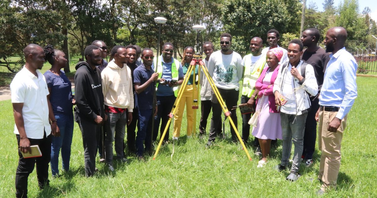
Kenya National Highways Authority (KeNHA) is equipping Egerton University students with practical skills on using modern land surveying tools and instruments that are crucial for road and highway construction to address the industrial skills gap and boost the graduates’ employability.
Dean of the Faculty of Engineering and Technology Prof. Japheth Onyando said the training was focused on empowering the students with practical skills in using modern surveying techniques like total stations, theodolites, leveling instruments, and Global Positioning System (GPS) technology.
The Don added that the practical training entailed setting up and operating equipment, making observations, and processing data, learning about conducting different types of surveys like topographic and control, and conducting construction surveys.
Prof. Onyando said the hands-on training was designed to prepare students to confidently use surveying instruments in real-world construction projects, making them more job-ready and valuable to employers and the industry.
He indicated that the practical training programme in partnership with KeNHA was aligned with industry standards and best practices to ensure that students developed the necessary skills and knowledge for success in the field.
Prof. Onyando highlighted the importance of engineering training moving away from a purely academic model towards a practice-centered approach that prepared students for the needs of the industry.
He explained that the practical experience would ensure students understood how to collect and interpret data, apply the data to real-world situations, and ultimately produce accurate and safe road projects.
“KeNHA experts are providing hands-on instruction, ensuring students learn industry standards,” added the Dean.
According to KeNHA, a total station is a surveying instrument that combines an electronic theodolite and an electronic distance measuring device (EDM) to measure horizontal and vertical angles and distances. It is used to collect data for detailed maps, plans, and 3D models, making it a vital tool in construction, engineering, and land surveying projects.
According to the dean, the exposure to practical training enables students to encounter real-world problems and challenges, compelling them to think critically and develop problem-solving skills. This, he added, is essential for addressing issues that may arise during construction, such as obstacles or unexpected conditions.
Surveyors use GPS receivers to collect data, including latitude, longitude, and elevation, which is crucial for tasks like mapping, construction layout, and monitoring structural movement.
Prof. Onyando noted that total stations and GPS are essential for precise measurements and data collection in the field and are critical for accurate planning and execution of road and highway projects.
While appreciating the training gesture, Prof. Onyando said they were determined to ensure that their students become competent professionals in road and highway construction, ensuring the safety, efficiency, and cost-effectiveness of infrastructural projects.
He was happy that the collaboration with KeNHA was strengthening the initiative by providing students with access to real-world expertise and resources.
The students have been taken through practical performance of levelling activities which involved determining heights in relation to a known height, using tools like dumpy levels and leveling staffs, which are essential for setting road levels and managing cut and fill, added the dean.
He further said that the students were also learning how to collect, process, and present geospatial data, which is vital for the design, implementation, and monitoring of engineering projects like road construction.
Prof. Onyando noted that correct use of tools like theodolites, total stations, and GPS to precisely measure distances, angles, and elevations was fundamental in ensuring that roads and highways are built to the correct dimensions and specifications.
The Dean noted that hands-on experience allowed students to apply the theoretical concepts they had learned in the classroom, such as coordinate systems, leveling methods, and data processing techniques. This, he added, helps solidify their understanding and develop practical skills.
He added that proper use of survey tools and instruments required safety protocols and maintaining precision in measurements that allow students to develop the skills and build good habits that are crucial for a safe and accurate construction process.
By Esther Mwangi


