
The government in collaboration with stakeholders is developing a comprehensive national Marine Spatial Plan (MSP) to unlock abundant opportunities found in ocean spaces.
The spatial plan is a national strategy to manage and utilize marine and coastal resources by balancing ecological, social and economic objectives.
It is a 20-year strategic framework approved by the Cabinet and is designed to guide the sustainable and integrated use of ocean space, ensuring a balance between economic growth, environmental conservation and social equity.
Maritime stakeholders contend that MSP is indispensable to sustainably grow the blue economy sector and preserve the fragile marine ecosystem.
The plan offers a science-based framework for optimizing ocean resources, protecting biodiversity and enhancing coastal livelihoods.
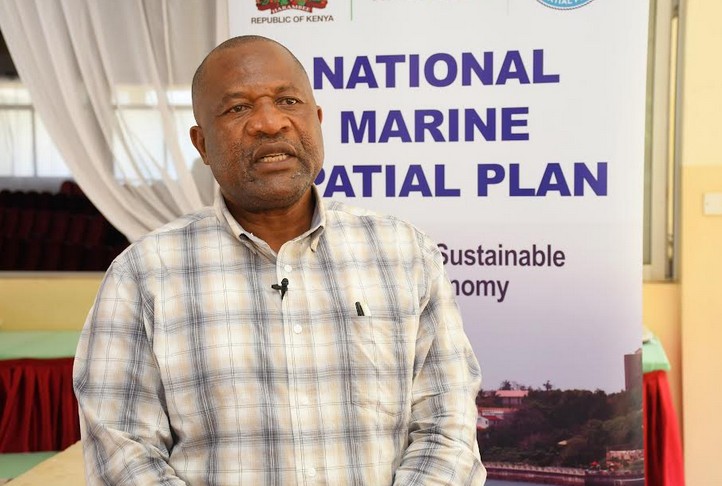
John Ntabo, Deputy Director, State Department for Lands and Physical planning says MSP will lead to improved environmental management by protecting ecosystems to enhance climate resilience, foster sustainable economic growth and blue economy.
The blue economy encompasses a range of marine-related sectors that contribute to economic growth, improved livelihoods and job creation. while ensuring the health of marine ecosystems.
The blue economy sector encompasses fisheries, maritime biotechnology, aquaculture, tourism, and marine transport and logistics.
He said MSP aligns with Vision 2030 by providing a strategic framework for managing marine resources, promoting the sustainable blue economy, and guiding development in a coordinated way.
“ MSP supports the Vision 2030 objectives by providing a spatial plan for both coastal and offshore development, ensuring that activities like fishing, tourism, and energy exploration are conducted in an organized and sustainable manner, while balancing economic growth with conservation and climate resilience,” he said.
Ntabo said MSP will support the blue economy which he termed as the ‘next frontier of development’, enhance economic development, create livelihoods and ensure food and nutrition security.
The Deputy Director was speaking during a crucial community engagement session in Kwale county to advance MSP, with the forum seeking to raise awareness, build capacity for meaningful participation, and gather local perspectives on resource use, conservation, and development priorities.
“ MSP will promote integrated governance and sustainable use of marine and coastal resources, support coordinated multisectoral planning and infrastructure development, facilitate collaboration among government agencies and establish guidelines, standards and regulations for conservation and sustainable utilization of marine resources,” he said.
He said MSP is a process of sustainably managing the use of marine spaces by coordinated activities like fisheries, tourism, shipping, renewable energy and maritime transport.
The senior physical planner said the MSP will cover Kenya’s 640 km coastline, which stretches from Kiunga in the north (near the Somali border) to Vanga in the south (near the Tanzanian border).
Ntabo says MSP aims to provide legal certainty for investments, prevent resource conflicts and protect ecosystems by ensuring the long-term sustainability of marine environments through integrated planning.
“Kenya’s marine resources are of great economic, social and environmental importance,” he said.
Ntabo said the marine spatial plan being spearheaded by the Ministry of Mining, Blue Economy and Maritime Affairs is based on an integrated approach to balance economic, ecological, and social objectives.
He said the marine plan is being developed with support from the World Bank through the Sh10 billion Kenya Marine Fisheries Socio-economic Development (KEMFSED) Project.
The KEMFSED project is being implemented by the State Department for Blue Economy and Fisheries with support from the World Bank with the project duration scheduled for 2020-2025.
The fishery infrastructure project is being implemented in the coastal counties of Mombasa, Kwale, Kilifi and Lamu to enable fisher folks to increase catches and improve livelihood activities in coastal communities.
Ntabo said there are significant challenges in managing ocean resources sustainably including pressures from overfishing, uncontrolled coastal developments, global warming, acidification and pollution.
Therefore, the MSP forum seeks to identify solutions towards cross-sectoral actions to conserve the ocean and use its resources in a sustainable manner.
He said MSP is now at stakeholders and public consultation stages before it proceeds to a draft document in March 2026.
Elizabeth Mulwa, Deputy Director of Fisheries at the Kenya Fisheries Service, said the benefits of the MSP includes reducing conflicts between users, balancing economic, social and environmental objectives through clear zoning for long term strategies.
“The MSP is an ecosystem-based approach that will guide how the ocean is sustainably used and protected for posterity,” she said, adding that the MSP is part of a broader strategy to develop a sustainable blue economy.
Mulwa said the marine spatial plan is a ‘policy roadmap’ designed to prioritize sustainable development within Kenya’s maritime domain.
“We are developing an integrated MSP to harness the vast maritime opportunities,” she said, adding that the MSP focuses on the use of space at sea and the consequent development of the blue economy and fisheries.
The country’s maritime domain is seven nautical miles from the shore, and within the Exclusive Economic Zone (EEZ) of 200 nautical miles from the shore.
Kenya’s EEZ is a 200 nautical mile (370 km) area extending outwards from its coastline, granting the country sovereign rights over its resources such as fisheries, oil and gas, as well as other seabed minerals within that zone.
The senior fisheries official says the demand for maritime space and marine resources is growing rapidly calling for a careful balancing of competing interests at sea.
Kwale County Executive Committee Member (CEC) for Agriculture and Fisheries, Roman Sherah, has praised the marine spatial planning efforts particularly its focus on integrating land use and sea planning and developing a sustainable blue economy.
“The spatial plan will lead to the establishment of new marine conservation areas for sustainable coastal development,” he said.
Sherah said the coastal county of Kwale will adopt and implement the marine spatial plan as a key tool for sustainable ocean governance.
He said marine spatial planning and integrated ocean management are important tools for governance, science-based decision making and inclusive governance.
Juma Mwabori, Mwaembe Beach Management Unit chairman in Msambweni sub county of Kwale has welcomed the national MSP as it provides a framework to resolve conflicts over marine resources and promote sustainable use of ocean spaces.
Mwabora, who comes from a long line of fishermen, says the government’s marine spatial plan action signals its commitment to a sustainable exploitation of the blue economy and fisheries sector.
“We welcome a marine spatial plan, a product of a shared vision by all stakeholders that sustainably manages our marine resources for posterity,” he said.
The chairman said the MSP will bring aspects of legal certainty for investments and community welfare improvements.
by Hussein Abdullahi


