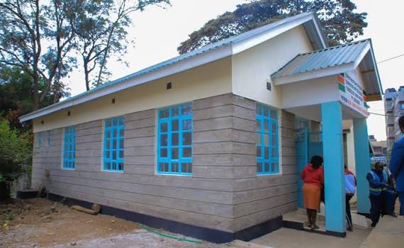
Residents of Ruiru will now have easier access to land survey services, following the establishment of a dedicated survey office in the constituency, ending years of reliance on facilities outside the area.
The office, located in Biashara Ward, was officially opened on August 24, 2026, by Ruiru Member of Parliament (MP), Simon King’ara, and has been operational since then.
It is expected to offer services such as boundary verification, access to land maps, and surveying advice, all critical to land transactions, subdivision, and the processing of title deeds.
The Ruiru Land Registry was established in 2019 after land administration services were decentralized from Thika.
However, in the absence of a dedicated survey office, residents continued to face challenges accessing surveying services, with surveyors operating out of the NG-CDF offices since 2021.
Speaking on the development, King’ara explained the gap that has existed since the registry opened its doors.
“We got the land registry in Ruiru in 2019, but we did not have a survey office. Since 2021 the surveyors have been operating from the NG-CDF offices, and it has been quite challenging,” he said.
The MP added that the new office would significantly cut the time and cost residents previously incurred while traveling outside the constituency to access services.
He also disclosed that plans were at an advanced stage to establish a modern land administration complex that would bring multiple departments together under one roof, allowing residents to access several services from a single location.
The office is expected to improve coordination between surveyors and land registration officials, making it easier for residents to follow up on land transactions and resolve boundary or parcel measurement disputes.
Ruiru Lands Registrar, Robert Mugendi, weighed in on the significance of the new facility, emphasizing the foundational role surveying plays in land ownership.
“Surveying is an important stage in the process of land ownership because it establishes the size and location of a parcel before the information can be reflected in land records,” he said.
He noted that survey services are equally important in resolving boundary disputes, verifying parcel measurements, and supporting the preparation of documents required during land transactions.
This comes at a time when land transactions in Ruiru have increased alongside rapid urban development, making accurate surveying, mapping and boundary verification increasingly important.
The State Department for Lands lists Ruiru among centers offering land registration, administration, valuation, survey, and mapping services.
By Winjoy Makena and Grace Naishoo