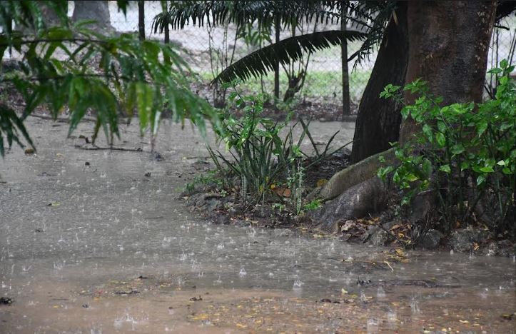
Nyeri is among the counties expected to start receiving the short rains during the second and third weeks of October.
A climate outlook report by the Kenya Meteorological Service Authority (KMSA) released on August 26 has listed the county among 20 others expected to start receiving the short rains in early October.
Other counties expected to experience the October-November –December rains from the second and third week of October include Nyandarua, Murang’a, Meru, Nairobi, Kwale, Kilifi, Mandera, Garissa and Isiolo among others.
The short rains which traditionally fall between October and December are expected to extend to early January next year, according to KMSA.
Other counties like Machakos, Kajiado, Taita Taveta, Tana River, Turkana, Samburu and Makueni will receive the rains between the third and fourth week of October.
The rains are however expected to have ceased by early December.
On the other hand, Nandi, Kakamega, Siaya, Nakuru, Kisii Kericho, Homa Bay and Narok counties are expected to start receiving the OND rains from September.
The weatherman predicts the distribution of the rains to average between fair to good with counties like Turkana and Samburu slated to fall under the poor to fair bracket.
“The OND 2026 rainfall is expected to be fairly to well distributed in time and space, over several parts of the country except over Turkana and Samburu where the distribution is likely to be poor to fair. This season will be marked by prolonged wet spells and occasional isolated storms over several parts of the country,” read part of the seasonal climate outlook signed by KMSA acting Director General Mr Charles Mugah.
In terms of intensity, Turkana, Samburu, Marsabit and a few parts of West Pokot are predicted to receive near-average to above-average rainfall.
However, most parts of the country are expected to experience above -average rainfall for the period under review with the expected El Nino event expected to greatly influence the intensity of rain that will be recorded in many of the counties.
“The Climate Outlook for the October –December 2026 “Short Rains” season indicates that above-average rainfall is expected over Baringo,Bomet,Bungoma,Busia,Elgeyo, Marakwet,Embu,Garissa,HomaBay,Isiolo,Kajiado,Kakamega,Kericho,Kiambu,Kilifi,Kirinyaga,Kisi,Kisumu,Kitui,Kwale,Laikipia,Lamu,Machakos,Makueni,Mandera,Meru,Migori,Mombasa,Nairobi,Nakuru,Nandu,Narok,Nyamiara,Nyandarua,Nyeri,Siaya,Taita Taveta,Tana River,Tharaka-Nithi,Trans Nzoia,Uasin Gishu,Vihiga,Wajir and much of West Pokot,Samburu and Marsabit counties, ” continued the press statement.
In terms of impacts, Kemsa says the short rains will have both adverse and positive effects across various sectors which will be highlighted by sector leads.
Meanwhile Nyeri County Director of Meteorological Services Peter Wambugu has clarified that the department will release the official El Nino weather outlook on Friday this week.
Wambugu stated that they are still awaiting the global weather analysis on the weather phenomena often marked by heavy rains and floods before they can release the information to the relevant stakeholders and the general public.
“The El Nino weather report will be released on Friday under the National Climate Outlook before it can be cascaded to the counties,” clarified Wambugu.
In a press statement released on July 3 this year, the World Meteorological Organization(WMO) said El Nino conditions had developed in the tropical Pacific and are forecast to strengthen rapidly over the coming months, increasing the likelihood of heatwaves, droughts, heavy rainfall and other extreme events in many parts of the world.
Land areas bordering the northern Gulf of Guinea are forecast to receive above –normal rainfall, in contrast to below-normal rainfall for the Greater Horn of Africa, according to the report.
El Nino is a naturally occurring climate pattern typically associated with increased heat worldwide, as well as drought in some parts of the world and heavy rains in other parts.
The phenomenon typically occurs every two to seven years often lasting between nine and one year characterized by large-scale warming of surface temperatures in the central and eastern equatorial Pacific Ocean.
It usually occurs on average every two to seven years and lingers for a period of nine to 12 months.
El Nino events are typically associated with increased rainfall in parts of southern Latin America, the southern United States, the Horn of Africa and central Asia.
Kenya experienced one of its most memorable El Nino phenomena in 1997 followed by three similar ones in 2006, 2015 and 2019.
However, the 1997 El Nino rains were conspicuously enhanced due to a high positive El Nino and Indian Ocean Dipole (IOD) index which stood at 2.6
The consequent El Nino in 2015 had a higher index but led to lower rainfall, causing less significant effects than had been anticipated.
By Samuel Maina